Presenting Nicaragua Pacific: The Complete Collection
16 August 2022Nicaragua Pacific is the definitive data source for your frontier exploration. Recently operated and de-risked by Equinor, this region is a promising candidate for new discoveries.
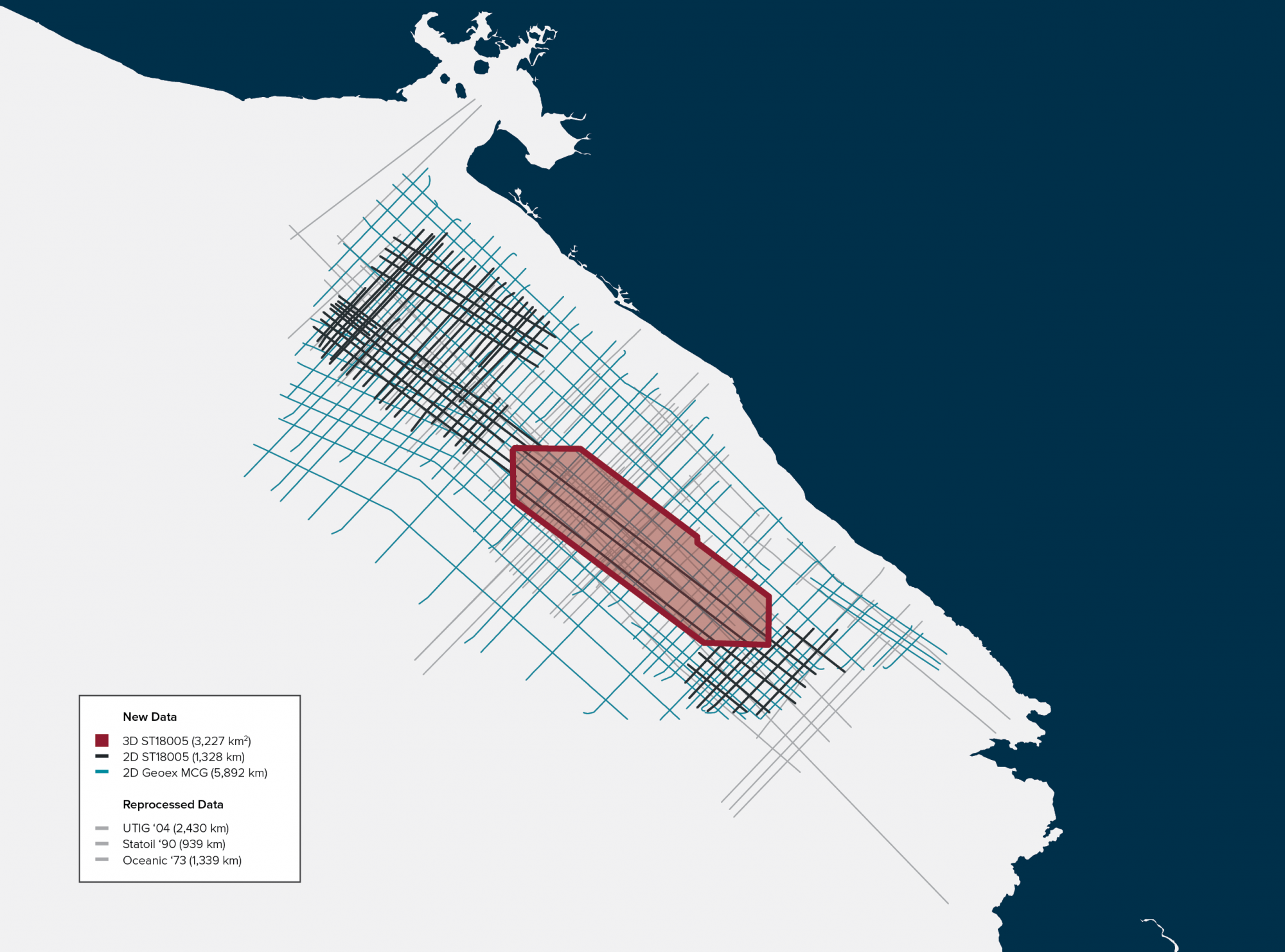
This complete data package (PSTM & PSDM) was expanded in 2022 and incorporates all available data in the region:
- 3D & 2D data acquired in 2018
- 2D data acquired in 2015 by Geoex MCG
- Legacy 2D data acquired between 1973-2003
Datasets are available for viewing, please contact:
Jean-Philippe Rossi
jp.rossi@geoexmcg.com
+44 7729 107 409
Download the flyer:
Geological Prospectivity
The Pacific Coast of Nicaragua comprises the Sandino Basin - a fore-arc basin located in front of the Caribbean Plate of Nicaragua, which was developed during the Cretaceous and contains up to 10,000 meters of Cretaceous and Tertiary sediments. This basin comprises 160 km of the Middle American Trench and extends onshore through the Nicaraguan Depression.
Reservoir and source rocks have been identified in the Sandino basin. The sedimentary infill of Sandino basin represents a prograding succession of sediments grading from deep (pelagic to slope deposits) to shallow marine to transitional continental system.
Program Parameters
Parameter | 3D ST18005 | 2D ST18005 | 2D Geoex MCG | Legacy Data |
Data size | 3,227 km2 | 1,328 km | 5,892 km | 4,708 km |
Data type | 3D seismic | 2D acq. with a 3D vessel | 2D seismic | 2D seismic |
Gravmag | Yes | Yea | N/A | N/A |
Year | 2018 | 2018 | 2015 | 1973, 1990, 2004 / |
Streamer length / no. | 12 x 6,000 m | 12 x 6,000 m | 8,100 m | 2,100 to 3,216 m |
Sample rate | 2 ms | 2 ms | 2 ms | 1 to 4 ms |
Source volume | 3,480 in3 | 3,480 in3 | 3,850 in3 | 45 to 1,050 in3 |
Products | PSTM & PSDM | PSTM | PSTM | PSTM |