The Western Barents Sea
03 September 2015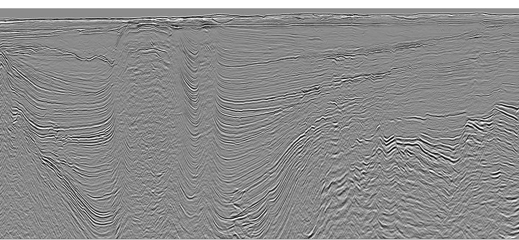
MultiClient Geophysical provides 32,320 km of modern seismic MC2D data in the western part of the Barents Sea. The data has been acquired in a regular 4 x 4 km grid, ranging from the Tromsø Basin in the south to the Stappen High in the north.
The data was acquired in six different surveys between 2009 and 2013. Streamer length is 8,100m and 10,000 m and the record length is 9 seconds. All data has been run through modern PSTM processing.
Full broadband reprocessing of the western Barents Sea seismic grid started in September 2015 and will be ready by end of March 2016.
The future core area for Norwegian oil production?
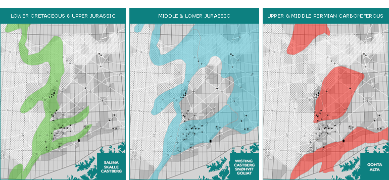
Based on interpretation of MCG’s modern seismic MC2D data, the western Barents Sea has:
- many near-term oil prospects with good chances of success
- new promising play fairways like Upper Cretaceous and Lower Tertiary
- more than 60 leads & prospects identified so far in Jurassic to Tertiary
Now is the time to get ahead of the competition!
For the full story and more information please contact us
Lars Ivar Leivestad
lars.ivar.leivestad@mcg.no
Tor Åkermoen
tor.akermoen@mcg.no