Geoex MCG Commences Reprocessing of the RDI MC2D in the Norwegian Sea
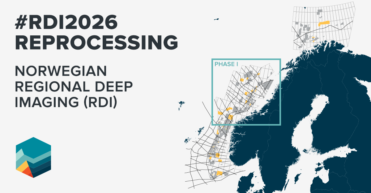
12 March 2026Geoex MCG has initiated Phase I (the Norwegian Sea) of the reprocessing programme for the Regional Deep Imaging (RDI) MC2D dataset in collaboration with RockWave.
The project is now underway and the fully reprocessed dataset is scheduled for availability in Q4 2026.
Where Commercial Opportunity Meets Technological Innovation and Geological Understanding
The RDI MC2D remains one of the most comprehensive regional datasets across the NW European Shelf. Acquired with an extended 16 s TWT record, it images the full crustal thickness and the entire sedimentary column in the deep Vøring and Møre basins as well as in the North Sea, providing a powerful framework for regional geological understanding.
The survey efficiently traverses major geological structures with significantly fewer profiles than comparable regional 2D programmes.
The regional interpretation is supported by work conducted with the Geological Survey of Norway (NGU) and the Norwegian University of Science and Technology (NTNU). Research by Peron Pindivic et al. (2023) on the Norwegian Sea dataset (RDI19) underpins the consistent margin‑domain framework applied across the area.
This reprocessing programme represents a technically innovative step-change for the dataset, applying the latest advancements in broadband processing, noise suppression and velocity model building.
Phase I of reprocessing focuses on delivering significant uplift to the Norwegian Sea portion of the survey through modern deghosting, designature, denoise and demultiple techniques, along with an enhanced velocity model for PSDM. These improvements will sharpen the imaging of Palaeozoic and Mesozoic stratigraphy and refine Top Basement definition, directly supporting improved charge modelling, reservoir prediction, and risk reduction during acreage evaluation.
With its exceptional depth penetration and regional continuity, the RDI MC2D provides the geological insight needed to understand source rock maturation and reservoir distribution across the Norwegian Sea.
This offers a strong commercial advantage for companies seeking to strengthen basin models, evaluate acreage and reduce exploration uncertainty.
Read more about the RDI project
Data Availability
The fully reprocessed Phase I dataset will be available in Q4 2026. For companies planning ahead of upcoming licensing rounds, the RDI MC2D offers strategic value as a cost‑effective regional tool for screening, maturing acreage, and integrating with existing Geoex MCG datasets such as Quad 35 Hybrid MC3D.
For further information, please contact Tor Åkermoen (CEO, Europe), Jamshade Khan (VP Sales)